
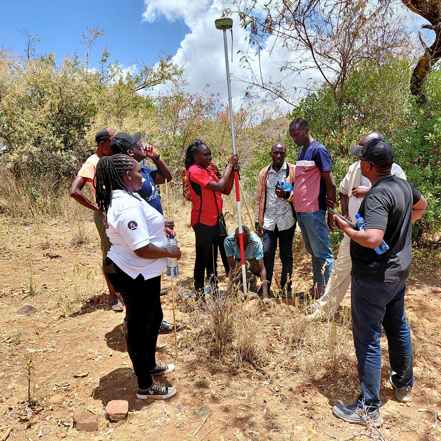
An ongoing demarcation and survey exercise in West Pokot and Turkana is advancing community land registration and strengthening the protection of pastoralist land rights and natural resources.
By identifying community boundaries, public utilities and shared resources, the exercise will help reduce land disputes, prevent encroachment and support sustainable planning and development.
The initiative brings together communities, government agencies and development partners to secure communal land, protect pastoralist livelihoods and build resilience for present and future generations.
An ongoing land demarcation and survey exercise in parts of West Pokot and Turkana counties has marked a significant step towards securing community land rights and strengthening natural resource governance in northern Kenya.
The exercise is being undertaken in Lokitonyala and Kalapata in West Pokot County, as well as Lokiriama, Lorengippi and Nakurio in Turkana County. It forms part of the broader community land registration process aimed at formally recognising and protecting land traditionally owned and managed by local communities.
For pastoralist communities, secure land rights are essential to protecting livelihoods, preserving access to grazing areas and water resources, and supporting mobility across communal landscapes. Formal registration also provides communities with a stronger legal foundation for managing their land, resolving disputes and participating in decisions concerning development and resource use.
The demarcation process involves identifying and confirming community land boundaries through consultations, technical assessments and surveying. It also helps distinguish community land from public and private land, reducing the risk of boundary disputes, encroachment and unplanned development.
Technical teams from the Ministry of Lands, Public Works, Housing and Urban Development, the National Land Commission and the Survey Council of Kenya are participating in the exercise. They are working alongside development partners and community representatives supporting the affected communities throughout the registration process.
A key component of the exercise is the identification and documentation of public utilities and other important community assets. These may include schools, health facilities, roads, water points, grazing areas and administrative centres.
Clearly identifying such facilities provides a reliable basis for future planning, infrastructure development and land administration. It also enables communities and government institutions to make informed decisions on the sustainable management of natural resources.
The process is particularly important in pastoral areas, where land is often managed collectively and supports interconnected systems of livestock production, seasonal movement and access to shared resources. Securing communal ownership can help protect these systems while ensuring that development initiatives respect existing land-use arrangements.
Community participation remains central to the exercise. By taking an active role in identifying boundaries, documenting resources and discussing land-use priorities, residents can help ensure that the registration process reflects local realities and safeguards community interests.
The initiative is being supported through a partnership involving the Drylands Learning & Capacity Building Initiative, Acted Kenya and the Food and Agriculture Organization of the United Nations in Kenya, with financial support from the Delegation of the European Union to Kenya.
The collaboration seeks to strengthen communities’ capacity to secure, manage and govern their land while promoting sustainable livelihoods and resilience in the drylands.
Once completed, the demarcation and survey exercise is expected to pave the way for subsequent stages of community land registration. Formal recognition of community land will provide greater tenure security and strengthen the ability of residents to protect their resources for present and future generations.
The initiative demonstrates how collaboration among communities, government agencies and development partners can advance inclusive land governance while reinforcing the resilience of pastoralist communities in northern Kenya.